
Parts of the Southeast were experiencing potentially life-threatening flash floods Saturday as a severe weather system made its way across the country, also posing a risk of significant snow for the Upper Midwest and New England.
The NWS warned early Saturday that severe flash flooding is likely in the Ohio and Tennessee valleys, particularly in parts of Kentucky and Tennessee. Around 20 million people are under some measure of flood alert from Arkansas to Pennsylvania.
“The greatest risk for this intense rainfall prompting life-threatening flash flooding will be across portions of northwestern Tennessee and western Kentucky, where a High Risk of Excessive Rainfall (level 4/4) is in effect,” the weather service said in its short-range forecast discussion.
Widespread and intense thunderstorms were expected to move over the region through the day, dropping up to 6 inches of rain in some places and isolated totals of up to 8 inches. The storms are expected to continue through early Sunday.
By Saturday afternoon, ongoing flash flooding was reported in parts of Tennessee and Kentucky, where more than 4 to 5 inches of rain has already fallen. A number of road closures were reported in the states due to flooding.
Joe Pitts, mayor of Clarksville, Tennessee, said in a statement there have been “alarming scenes of flash flooding on this Saturday, throughout Clarksville and surrounding areas,” after nearly 4 inches of rain fell on the area Saturday and another 1 to 2 inches was expected into the night. To prepare for the weather event, Pitts said local officials placed around 1,000 sandbags and barricades in areas that have historically seen flooding.
The National Weather Service in Nashville said it is expecting a line of intense storms overnight. Flash flood warnings in some areas of Tennessee are in effect.
The National Weather Service office in Blacksburg, Virginia, issued a flash flood warning until 10:45 p.m. Saturday after 1 to 3 inches had already fallen in the area, triggering flash floods in cities including Roanoke and Salem.
About 20,000 people in Virginia and almost 10,000 people in Kentucky were without power at 10:30 p.m. ET, according to tracking website PowerOutage.us.
One user on X posted footage of floodwaters inundating his yard and threatening his home in Gray, Kentucky.
Another post on X showed significant flooding on a highway in Cottontown, Tennessee.
In addition to flooding, there is also a risk of thunderstorms and strong tornadoes in portions of the lower Mississippi Valley, according to the National Weather Service. Destructive wind gusts up to 70 mph and hail are also possible.
Around 20 million people are under the risk for severe weather from east Texas to Georgia, including in cities such as Memphis and Nashville, Tennessee; Montgomery, Alabama; Baton Rouge, Louisiana; and New Orleans.
The NWS in Birmingham said severe storms, including tornadoes and damaging, straight-line winds, are expected to begin Saturday around 10 p.m. and could last until 5 a.m. Sunday. Parts of Arkansas, Louisiana, Mississippi, Tennessee and Texas are under tornado watches until 10 p.m. local time, according to the NWS office in Jackson, Mississippi.
As of 10:30 p.m. ET, more than 8,000 customers in Louisiana were experiencing power outages.
A broad area of rain and thunderstorms will persist across the mid-Atlantic and Southeast through the weekend, with isolated risks of heavy precipitation and flash flooding.
Meanwhile, farther north, moderate to heavy snowfall is expected from the Upper Midwest into the Great Lakes and New England. The heaviest snowfall — with possible totals in the double digits — is expected in Michigan, upstate New York, Vermont, New Hampshire, northern Massachusetts and the interior of Maine, according to the National Weather Service.
Around 70 million people on Saturday were under winter weather alerts or warnings from Nebraska to Maine.
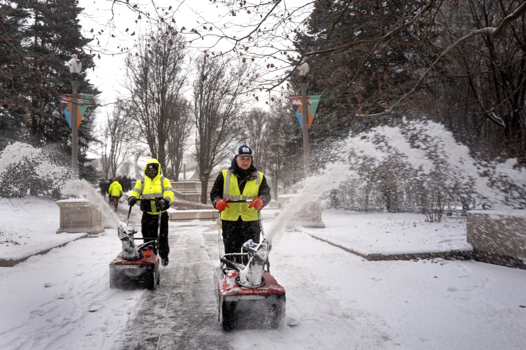
As of 2 p.m., 7 inches of snow had fallen in parts of Nebraska, Iowa and Michigan. The snow will target the Great Lakes and the Northeast Saturday night.
The snow will transition to a wintry mix, and eventually to rain, in major cities in like New York City and Philadelphia as a warm front lifts.
New England will see the highest snowfall totals, with 12 to 18 inches possible through Sunday.
The mix of sleet and freezing rain, expected across much of the Northeast, will make for challenging driving conditions.
“The greatest chances for significant ice accumulations from freezing rain are in the interior Northeast,” the NWS’ Weather Prediction Center said in an advisory posted on X. “Some locations are likely to see enough icing to cause power outages.”
The storm is expected to intensify in the Northeast late Saturday into Sunday.
“Increasingly strong and gusty winds may also lead to periods of blowing snow and very difficult travel conditions,” the weather service said.
By early next week, forecasts show rain and snow moving off the East Coast, but blustery winds will likely keep cold air over much of the eastern half of the country.
There will be 76 million people under wind alerts through the start of the week, including in Jacksonville, Florida; Asheville, North Carolina; New York City; Boston; and Washington, D.C., where wind gusts upward of 40 to 60 mph are possible.

Denise Chow
Denise Chow is a science and space reporter for NBC News.
Christine Rapp
Christine Rapp is a meteorologist for NBC News.

Rebecca Cohen
Rebecca Cohen is a breaking news reporter for NBC News Digital.